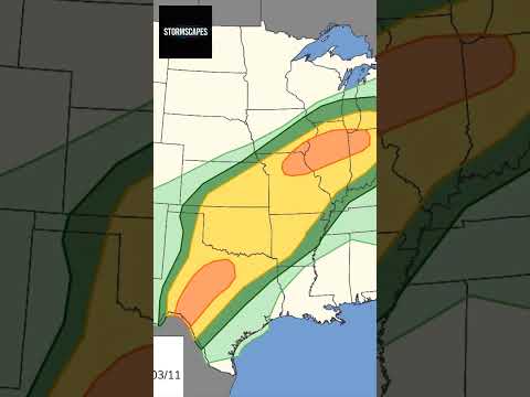
About this recording
Published 2026-04-13. Monday, April 13, 2026 brings an enhanced severe weather threat across parts of the Upper Mississippi Valley and Great Lakes, where late-day supercells could produce 2 to 3 inch hail, damaging winds, and tornadoes. Then on Tuesday, April 14, 2026, the severe threat spreads from the southern Plains to the Great Lakes, with the higher-end concern focused on eastern Iowa, northern Illinois, and southern Wisconsin. This archived recording reflects reporting at publication; conditions may have changed.
An archive briefing, not a real-time warning. Follow current instructions from local authorities.
Understand the reports
Use these explainers to interpret the measurements and warnings discussed in disaster coverage. They provide background, not updates to this archived briefing.